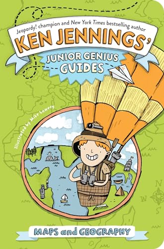
Items related to Maps and Geography (Ken Jennings’ Junior Genius...

Discover the fun facts about the world and become a master of geography with this interactive trivia book from Jeopardy! champ and New York Times bestselling author Ken Jennings.
With this Junior Genius Guide to maps and geography, you’ll become an expert and wow your friends and teachers with clever facts: Did you know that the biggest desert in the world is actually covered in snow? Or that Christopher Columbus wasn’t the first to think that the Earth was round? With great illustrations, cool trivia, and fun quizzes to test your knowledge, this guide will have you on your way to whiz-kid status in no time!
With this Junior Genius Guide to maps and geography, you’ll become an expert and wow your friends and teachers with clever facts: Did you know that the biggest desert in the world is actually covered in snow? Or that Christopher Columbus wasn’t the first to think that the Earth was round? With great illustrations, cool trivia, and fun quizzes to test your knowledge, this guide will have you on your way to whiz-kid status in no time!
"synopsis" may belong to another edition of this title.
About the Author:
Ken Jennings grew up in Seoul, South Korea, where he became a daily devotee of the quiz show Jeopardy! In 2004, he successfully auditioned for a spot on the show and went on an unprecedented seventy-four game victory streak worth $2.52 million. Jennings’s book Brainiac, about his Jeopardy! adventures, was a critically acclaimed New York Times bestseller, as were his follow-up books Maphead and Because I Said So! He is also the author of Planet Funny. Jennings lives in Seattle with his wife Mindy and two children.
Mike Lowery is an illustrator and fine artist whose work has been seen in galleries and publications internationally. Mike is the illustrator of Moo Hoo and Ribbit Rabbit by Candace Ryan; The Gingerbread Man Loose in the School by Laura Murray; and the Doctor Proctor’s Fart Powder novels by Jo Nesb�. Currently he is a professor of illustration at the Savannah College of Art and Design in Atlanta, Georgia, where he lives with a lovely German frau, Katrin, and his super genius daughter, Allister. Visit him at MikeLowery.com.
Excerpt. � Reprinted by permission. All rights reserved.:
Mike Lowery is an illustrator and fine artist whose work has been seen in galleries and publications internationally. Mike is the illustrator of Moo Hoo and Ribbit Rabbit by Candace Ryan; The Gingerbread Man Loose in the School by Laura Murray; and the Doctor Proctor’s Fart Powder novels by Jo Nesb�. Currently he is a professor of illustration at the Savannah College of Art and Design in Atlanta, Georgia, where he lives with a lovely German frau, Katrin, and his super genius daughter, Allister. Visit him at MikeLowery.com.
Maps and Geography
The Earth from Space
“Geography” comes from the Greek word for “description of the Earth.” “Geo-” means “Earth,” like in “geology.” The “-graphy” part means “to write,” like in “graphic” or “biography.” So geographers study and describe the Earth.
This is the Earth. It is our home, unless any of you are aliens who have secretly invaded our planet for your own purposes. If so, please see me after class.
You might have heard or read that Columbus proved the Earth was round in 1492, when he sailed from Spain to the Caribbean. This is not even close to true! By Columbus’s time, scientists had known the Earth was round for almost two thousand years.
The Shape the World Is In
The earliest Greek thinkers disagreed about the shape of the Earth. Thales thought it was a round, flat disk floating in water, like a pancake that’s fallen overboard at sea.
Anaximander thought the Earth was a cylinder, while Anaximenes (no relation) believed it was a flat rectangle floating on compressed air.
But by 500 BC or so, most people agreed with the philosophers Pythagoras and Aristotle: The Earth was round, like a ball. There was good evidence for this.
If you really want to celebrate the discovery of round Earth, don’t celebrate Columbus Day on October 12—celebrate Eratosthenes (“air-uh-TOSS-thuh-neez”) Day on June 21! Eratosthenes was the Greek who invented the word “geography” and a very smart guy—in fact, he was the head librarian at the ancient world’s largest library, in Alexandria. Around 240 BC, Eratosthenes devised a very clever experiment to measure the Earth. In late June, on the longest day of the year, he had two sticks placed straight in the ground in two different cities, five hundred miles apart, and measured their shadows. The shadows were different lengths, which meant the sticks weren’t parallel—the Earth was round after all!
What’s more, Eratosthenes could use the length of the shadow to calculate the size of the entire Earth, without ever leaving Egypt. His measurement was about 24,600 miles, and today we know that the Earth actually measures 24,902 miles around at the equator. Eratosthenes was off by just a few hundred miles!
The Accidental Tourist
Columbus, however, didn’t get the memo. For his 1492 voyage, he relied on maps made by Egyptian scientist Ptolemy (the P is silent, luckily, or his name would be a pterrible ptongue ptwister). Ptolemy’s math led him to believe that Europe and Asia were quite a bit wider than they actually are, so Columbus thought he could circle the Earth in just 16,000 miles! The world’s best navigators at the time were the Portuguese, and they knew this was crazy talk. Their own guess was close to Eratosthenes’s: about 26,000 miles. Columbus set off anyway, sure that he could get all the way to China and India in a matter of weeks. Luckily, there was a big unknown continent in the way (Spoilers! It was North America!) or he would have been lost at sea forever. India was four times farther away than he thought, and he would have run out of supplies months before arriving.
Doing Their Level Best
Despite all the geographical evidence, there are people who still believe that the Earth is flat. The largest organization for these unscientific souls is the Flat Earth Society, founded by a British sign painter in 1956, the year before the space age began.
The Earth proposed by this group is a big, flat disk like Thales suggested, with the North Pole in the center. Antarctica is a big wall of ice around the edge, which luckily keeps the oceans from leaking off!
The society’s membership peaked at about two thousand in the 1970s, but today it’s down to a few hundred true believers. Of course, it’s a lot harder to believe in a flat Earth now that spaceships and satellites are orbiting the Earth and sending back pictures all the time. During the 1950s, the society’s founder was given one of the first photos of a round Earth taken from space. “It is easy to see how such a picture could fool the untrained eye,” he calmly replied.
Let’s Not Wait; It’s a Really Long Line
The grid of north–south and east–west lines that you see on maps is used to mark latitude and longitude. (IMPORTANT NOTE: These lines are imaginary! You will not see them by looking out the window of an airplane!) Latitude is a measurement of how far north or south you are, while longitude measures east and west.
Official Junior Genius Way to Remember Which Is Which
“Latitude” lines go from side to side, like the rungs of a “ladder.” “Longitude” lines travel from the North to South Poles—a really “long” way.
If you were to stand at one of the poles, it would take the Earth’s rotation a full day to turn you in a circle—in other words, you’d be moving veeeeery slowly. But at the equator, the surface of the Earth rotates a lot faster. Standing “still” at the equator, you’re actually moving at 1,070 miles per hour, faster than the speed of sound!
Math Homework
If you have an atlas (or GPS device) and a calculator with a cosine key, you can find out how fast you’re spinning right now! Find your latitude in degrees, enter it into your calculator, and hit the COS button. Then multiply this answer by 1,070 miles per hour. Presto! That speed is your current velocity! Wow, you’re getting a pretty good workout.
Pop Quiz!
What country’s name actually means “equator” in its native language?
Do You Come From a Land Down Under?
South of the equator is the Southern Hemisphere. Of course, no one in the Southern Hemisphere ever “falls off” the Earth—gravity keeps Australians and South Africans and Argentines firmly on the ground, just as it does for Americans and Europeans. But there are a few differences Down Under.
Because the Southern Hemisphere is tipped toward the sun while the Northern Hemisphere is tipped away from it, their seasons are reversed: In the Southern Hemisphere summer starts in December, and August is the depth of winter.
So an Australian Christmas doesn’t have sleigh rides and chestnuts roasting on an open fire—it’s more likely to involve a barbecue and a trip to the beach!
The moon is upside down in the Southern Hemisphere too: The Man in the Moon’s eyes are at the bottom, and a waning (shrinking) crescent looks like this.
One thing that’s not different in the Southern Hemisphere: going to the bathroom! It’s sometimes said that toilets flush counterclockwise in the Northern Hemisphere and clockwise in the Southern, but that’s not true. There is a force called the Coriolis effect that makes big things, like weather systems, rotate differently in the two hemispheres, but a toilet is just too small to be affected.
East Is East and West Is West
Latitude at sea is pretty easy. Since ancient times, sailors have known how to judge their latitude from the height of the sun at noon. All you need to know is the date.
Longitude, however, was a lot harder. Today, we’re used to having GPS devices in our cars and phones, so it’s hard for us to understand that, just 250 years ago, there was no invention on Earth that could tell you how far west or east you were at any given time! Mostly, sailors had to guess about longitude and hope for the best.
In 1717, a terrible shipwreck off the coast of England sank four ships and killed over fourteen hundred sailors, including the heroic British admiral of the fleet Sir Cloudesley Shovell.
Junior Genius Joviality!
The next time you have a substitute teacher, make sure to tell the sub your name is Sir Cloudesley Shovell!
Shovell’s fleet, it turned out, had run aground because they’d calculated their longitude wrong. As a result of the disaster, the British government offered a �20,000 prize (over a million dollars in today’s money!) to the first scientist who could solve the longitude problem. There were lots of theories. Galileo had tried to compute longitude by carefully studying the moons of Jupiter. Other scientists tried to do it by measuring the distance between the sun and the moon or looking for irregularities in the Earth’s magnetic field.
The problem was finally solved with, of all things, a really good clock. Why a clock? Well, if you know what time the sun is supposed to set today back home in London, and you can tell what time the sun just set at your current location, then you know how far west or east of London you are. Unfortunately, good eighteenth-century clocks all used a swinging pendulum, which means they didn’t keep reliable time when a ship was bouncing around on a stormy sea. A clock maker named John Harrison solved this problem by inventing a clock that could keep accurate time on the waves, and he collected a hefty prize and died a very wealthy man.
Extra Credit
Before an international conference decided that the “zero” line of latitude, the prime meridian, would run through Greenwich, England, many maps used a meridian through Paris. In 1994, the city of Paris marked that old meridian—which still shows up on some French maps, even though everyone uses Greenwich today—with a string of 135 bronze medallions set into the ground. Not to be outdone, the Greenwich observatory installed a green laser that projects the prime meridian into the London sky every night.
Zoning Out
In 1884, a Canadian engineer named Sandford Fleming proposed dividing the world into twenty-four standard time zones, more or less the system we have today. At the time, there was no such thing as “standard time” in most countries. Until the 1880s, the United States alone was divided into more than eight thousand time zones, with each town setting its own local time based on the position of the sun at noon. This worked fine until railroads started to cross the country, and at that point thousands of time zones made train schedules very confusing.
The delegates at the conference decided not to institute Fleming’s time zone system, leaving it up to individual countries. Over the next fifty years, pretty much the whole world adopted some kind of “standard time” based on Fleming’s system, giving us the time zone map we have today.
You probably already know that when it’s noon on Monday in Los Angeles, it’s three in the afternoon in New York City. This continues across the globe: It’s already eight o’clock at night in London (so maybe the prime meridian laser just turned on at Greenwich). It’s midnight in Moscow and 4 AM in China and western Australia—in other words, it’s already tomorrow! At some point in our eastward journey, we need to jump back from tomorrow to today. That jump happens at the international date line, the zigzaggy line up there through the Pacific. On the west side of that line, it’s 6 AM Tuesday. An inch to the right, on the east side, it’s 7 AM . . . but on Monday.
This may seem silly, but what’s the alternative? To have it be the same time (say, 8 AM Monday) all over the world, even if the sun is setting in Cairo and it’s pitch-black in Tokyo? I’m sure you can agree, Junior Geniuses, that this would be even sillier.
Blast from the Past
Because of time zones, it’s quite possible to take off in an airplane and land at your destination at an earlier time than you left! Sportscaster Bob Costas likes to tell the story of traveling with a 1970s basketball team called the Spirits of St. Louis. The Spirits’ colorful star, Marvin “Bad News” Barnes, took a look at his itinerary at the airport one day and saw that his flight was leaving Louisville at 8 PM and arriving in St. Louis at 7:56 PM due to the change from eastern to central time. “I ain’t getting on no time machine!” Barnes told Costas, and walked off to rent a car instead.
Summertime Blues
The idea for daylight saving time was first dreamed up by Benjamin Franklin in 1784, but Americans didn’t start setting their clocks forward every summer until World War I and World War II, when conserving daylight meant conserving precious fuel.
All that clock changing can cause confusion. Every autumn when clocks fall backward one hour, Amtrak trains find themselves an hour ahead of schedule midjourney, so they just stop on the tracks and chill for an hour! An even weirder case happened in a Cary, North Carolina, hospital in 2007, as Laura Cirioli gave birth to twins one November night. Her son, Peter, was born first, at 1:32 AM. But then the clocks moved back one hour to end daylight saving, and her second twin, Allison, was born thirty-four minutes later, at 1:06 AM. So she’s technically twenty-six minutes older than her brother, who was born first!
Pop Quiz!
What’s the only state in the Lower 48 states that doesn’t observe daylight saving time?
The World’s Five Most Confusing Time-Zone Tangles
NEPAL. Most of the Earth’s many time zones differ from Greenwich time by a certain whole number of hours: Brazil is three hours earlier, Ethiopia is five hours later. A few places are offset by a half-hour difference. But Nepal, in the Himalayas, is the only country with a fifteen-minute difference! That’s right: When it’s ten in India, it’s ten fifteen next door in Nepal! That’s because Nepal still uses its most sacred mountain, Gauri Sankar, as its own private meridian instead of adopting India’s standard time. Locals call the fifteen-minute gap “Nepali stretched time” and use it as an excuse to be a little late for appointments.
KIRIBATI AND SAMOA. For its first fifteen years of independence, the Pacific island nation of Kiribati straddled both sides of the international date line, so it was always two different days at the same time in Kiribati! In 1995, it moved its remote eastern islands into the same time zone as its western half. Coincidentally—or not—this change makes eastern Kiribati the first nation on Earth to celebrate the New Year every year. This was a big tourist draw when the new millennium dawned on December 31, 1999!
"About this title" may belong to another edition of this title.
- PublisherLittle Simon
- Publication date2014
- ISBN 10 1442473282
- ISBN 13 9781442473287
- BindingPaperback
- Number of pages160
- IllustratorLowery Mike
- Rating
Buy New
Learn more about this copy
US$ 8.84
Shipping:
FREE
Within U.S.A.
Top Search Results from the AbeBooks Marketplace
Stock Image
Maps and Geography (Ken Jennings Junior Genius Guides)
Published by
Little Simon
(2014)
ISBN 10: 1442473282
ISBN 13: 9781442473287
New
Softcover
Quantity: 1
Seller:
Rating
Book Description Condition: New. Lowery, Mike (illustrator). . Seller Inventory # 52GZZZ0091L7_ns
Buy New
US$ 8.84
Convert currency
Stock Image
Maps and Geography (Ken Jennings Junior Genius Guides)
Published by
Little Simon
(2014)
ISBN 10: 1442473282
ISBN 13: 9781442473287
New
Softcover
Quantity: 3
Seller:
Rating
Book Description Condition: New. Lowery, Mike (illustrator). . Seller Inventory # 5AUZZZ0001BX_ns
Buy New
US$ 9.27
Convert currency
Seller Image
Maps and Geography (Ken Jennings Junior Genius Guides) by Jennings, Ken [Paperback ]
Published by
Little Simon
(2014)
ISBN 10: 1442473282
ISBN 13: 9781442473287
New
Soft Cover
Quantity: 10
Seller:
Rating
Book Description Soft Cover. Condition: new. Lowery, Mike (illustrator). Seller Inventory # 9781442473287
Buy New
US$ 9.90
Convert currency
Seller Image
Maps and Geography (Ken Jennings? Junior Genius Guides)
Published by
Little Simon
(2014)
ISBN 10: 1442473282
ISBN 13: 9781442473287
New
Paperback
Quantity: 5
Seller:
Rating
Book Description Paperback. Condition: New. Lowery, Mike (illustrator). New with remainder mark. Buy multiples from our store to save on shipping. Seller Inventory # 2010270034
Buy New
US$ 6.35
Convert currency
Seller Image
Maps and Geography
Published by
Little Simon
(2014)
ISBN 10: 1442473282
ISBN 13: 9781442473287
New
Softcover
Quantity: 5
Seller:
Rating
Book Description Condition: New. Lowery, Mike (illustrator). Seller Inventory # 20113079-n
Buy New
US$ 8.30
Convert currency
Stock Image
Maps and Geography Format: Paperback
Published by
Simon and Schuster
(2014)
ISBN 10: 1442473282
ISBN 13: 9781442473287
New
Softcover
Quantity: > 20
Seller:
Rating
Book Description Condition: New. Lowery, Mike (illustrator). Brand New. Seller Inventory # 9781442473287
Buy New
US$ 7.08
Convert currency
Stock Image
Maps and Geography (Ken Jennings' Junior Genius Guides)
Published by
Little Simon
(2014)
ISBN 10: 1442473282
ISBN 13: 9781442473287
New
Softcover
Quantity: 1
Seller:
Rating
Book Description Condition: New. Lowery, Mike (illustrator). Buy with confidence! Book is in new, never-used condition. Seller Inventory # bk1442473282xvz189zvxnew
Buy New
US$ 14.46
Convert currency
Stock Image
Maps and Geography (Ken Jennings' Junior Genius Guides)
Published by
Little Simon
(2014)
ISBN 10: 1442473282
ISBN 13: 9781442473287
New
Softcover
Quantity: 1
Seller:
Rating
Book Description Condition: New. Lowery, Mike (illustrator). New! This book is in the same immaculate condition as when it was published. Seller Inventory # 353-1442473282-new
Buy New
US$ 14.46
Convert currency
Seller Image
Maps and Geography (Paperback)
Published by
Simon & Schuster
(2014)
ISBN 10: 1442473282
ISBN 13: 9781442473287
New
Paperback
Quantity: 1
Seller:
Rating
Book Description Paperback. Condition: new. Lowery, Mike (illustrator). Paperback. Discover the fun facts about the world and become a master of geography with this interactive trivia book from Jeopardy! champ and New York Times bestselling author Ken Jennings. With this Junior Genius Guide to maps and geography, you'll become an expert and wow your friends and teachers with clever facts: Did you know that the biggest desert in the world is actually covered in snow? Or that Christopher Columbus wasn't the first to think that the Earth was round? With great illustrations, cool trivia, and fun quizzes to test your knowledge, this guide will have you on your way to whiz-kid status in no time! Discover fun facts about the world and become a master of geography with this interactive trivia book from "Jeopardy!" champ Ken Jennings. Shipping may be from multiple locations in the US or from the UK, depending on stock availability. Seller Inventory # 9781442473287
Buy New
US$ 14.49
Convert currency
Stock Image
Maps and Geography
Published by
Simon & Schuster
(2014)
ISBN 10: 1442473282
ISBN 13: 9781442473287
New
Softcover
Quantity: 4
Seller:
Rating
Book Description Condition: New. Lowery, Mike (illustrator). pp. 160. Seller Inventory # 2697105278
Buy New
US$ 10.51
Convert currency